 ar
ar bg
bg hr
hr cs
cs da
da nl
nl fi
fi fr
fr de
de el
el hi
hi it
it ko
ko no
no pl
pl pt
pt ro
ro ru
ru es
es sv
sv tl
tl iw
iw id
id lv
lv lt
lt sr
sr sk
sk sl
sl uk
uk vi
vi et
et hu
hu th
th tr
tr fa
fa ms
ms hy
hy ka
ka ur
ur bn
bn mn
mn ta
ta kk
kk uz
uz ku
ku
Integrated GNSS
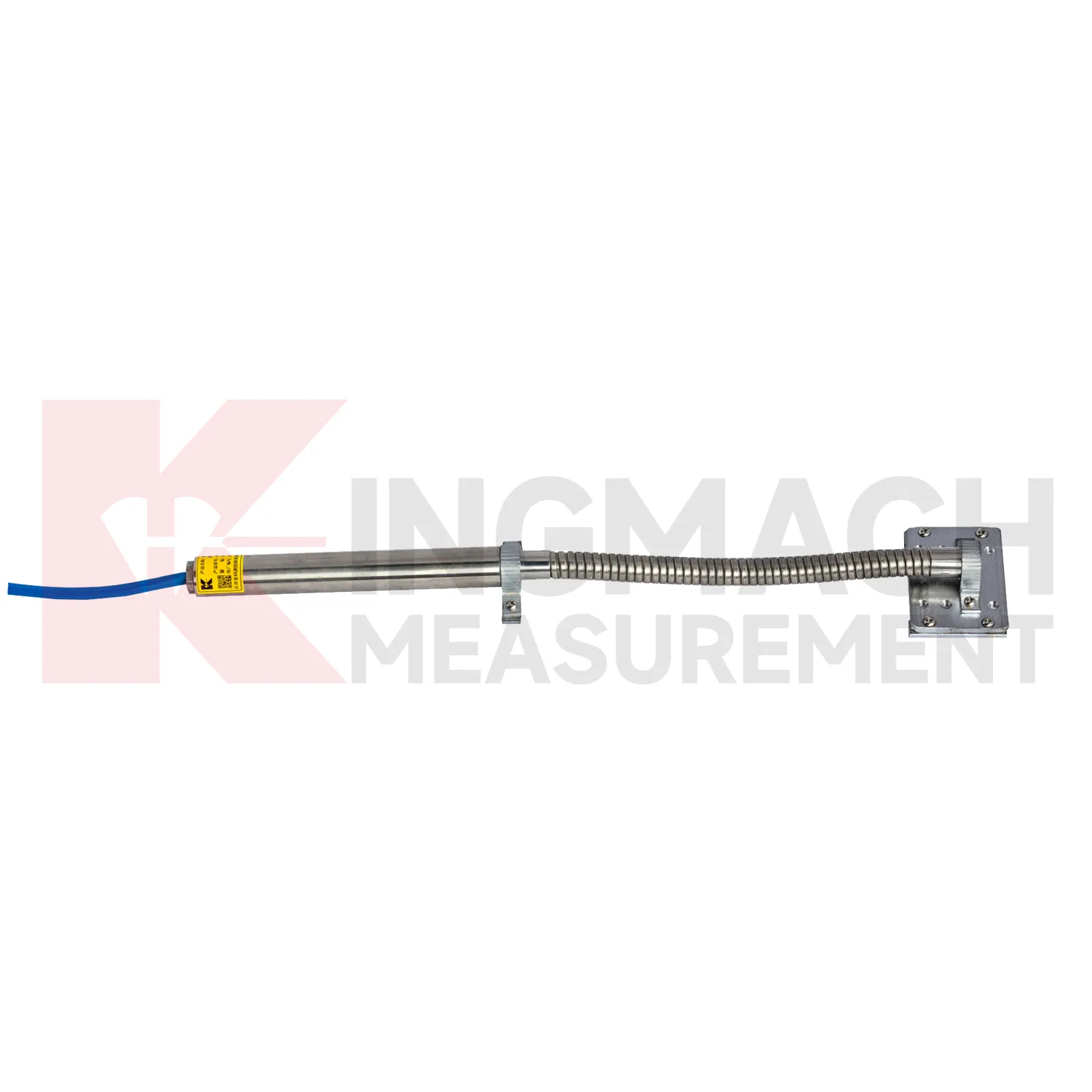
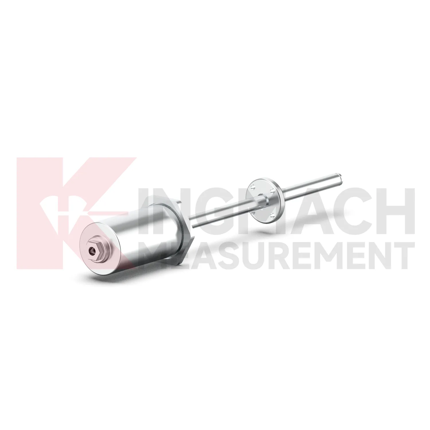
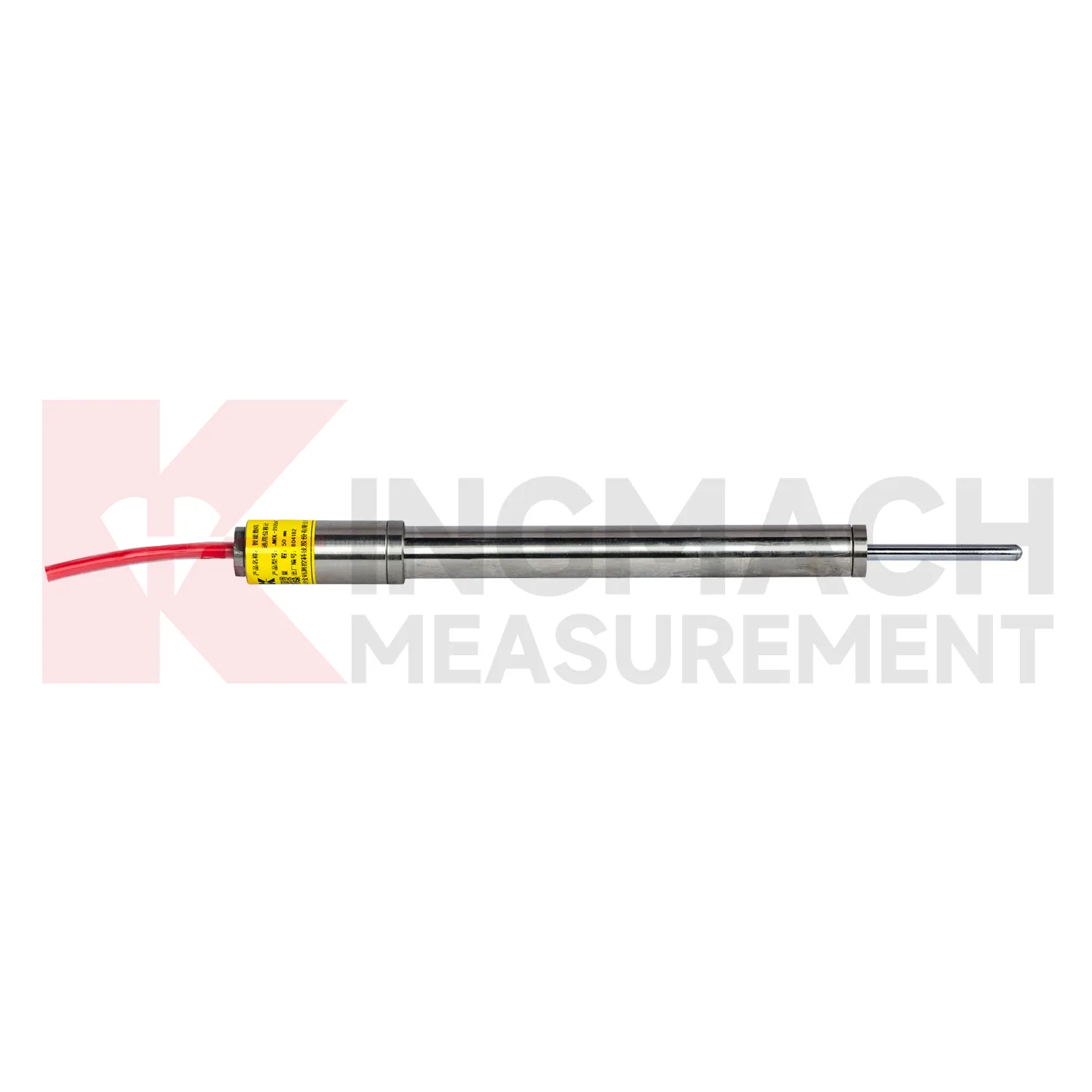
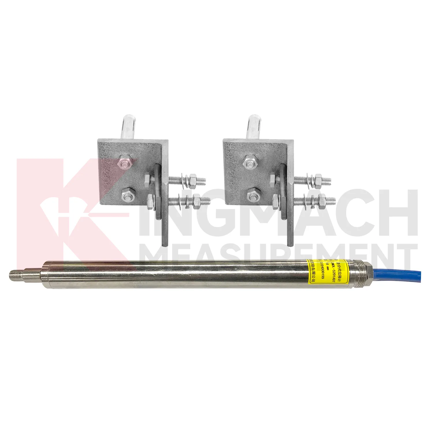
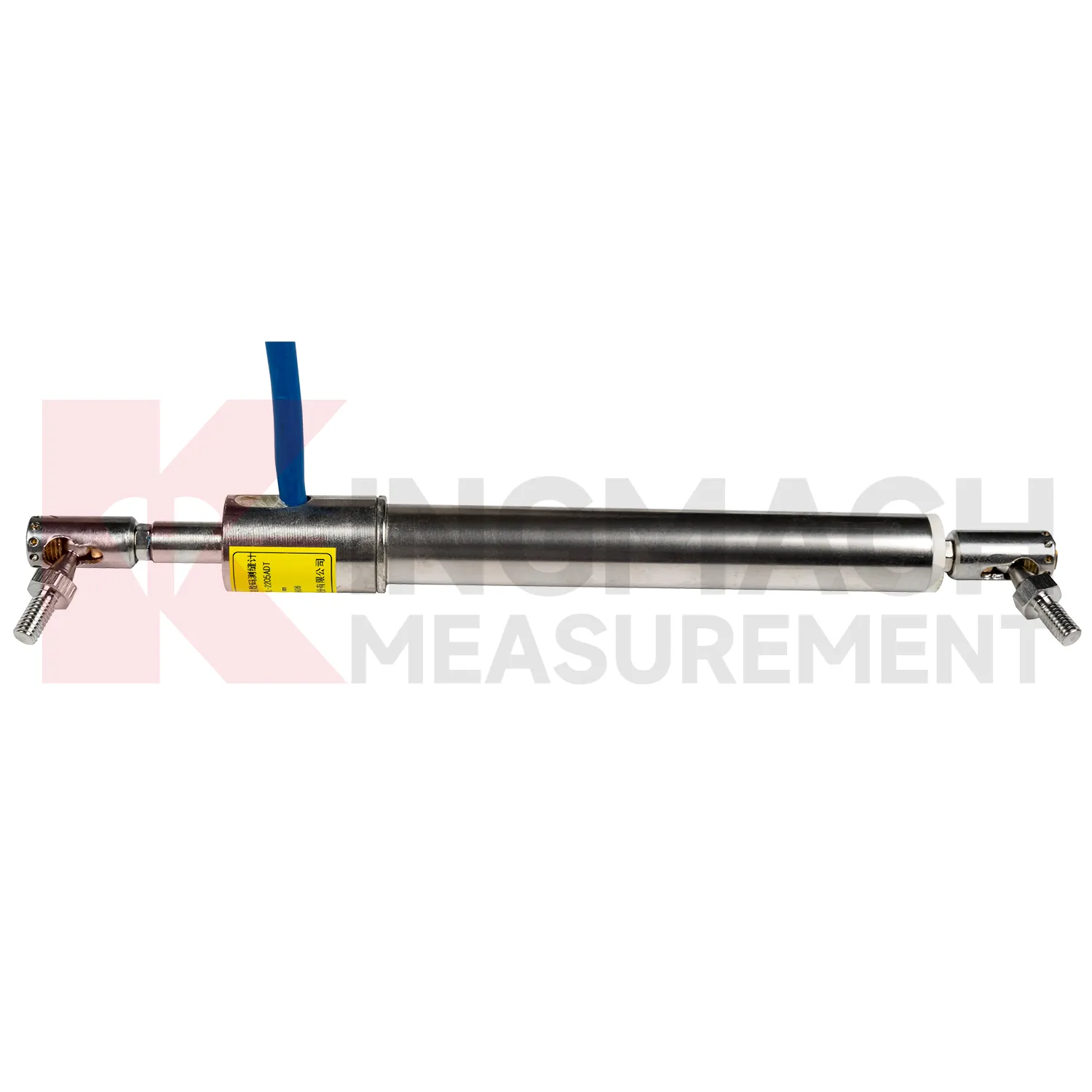
Kingmach Integrated GNSS include the JMDL-31XXAT Smart Multipoint Displacement Meter for tunnels, rock slopes, foundation pits, and surrounding rock layers. This product is not used like a surface joint gauge. It is built for boreholes where movement must be separated by depth. The instrument group includes displacement gauges, PVC measuring rod protective tubes, anchor heads, and multipoint installation kits that support three to five points. During installation, the borehole is prepared, anchor heads are set at selected layers, and grouting fixes each anchor to its target rock or soil zone. Listed models include 50 mm, 100 mm, and 200 mm ranges, all with 0.01 mm resolution. The sensing circuit changes output frequency as the measuring rod moves through the coil, so each channel can report how one anchored layer moves relative to the reference head. This layout is useful when tunnel crown movement, slope slip, or foundation pit deformation may start at one depth before it appears elsewhere. Field records should emphasize borehole number, anchor depth, grout condition, channel order, and the direction of expected movement. During later review, engineers can compare shallow and deep anchors to judge whether the deformation is local relaxation, progressive sliding, or full-section movement. That layered view is the main reason to use a multipoint instrument instead of several unrelated surface gauges.
Application of Integrated GNSS
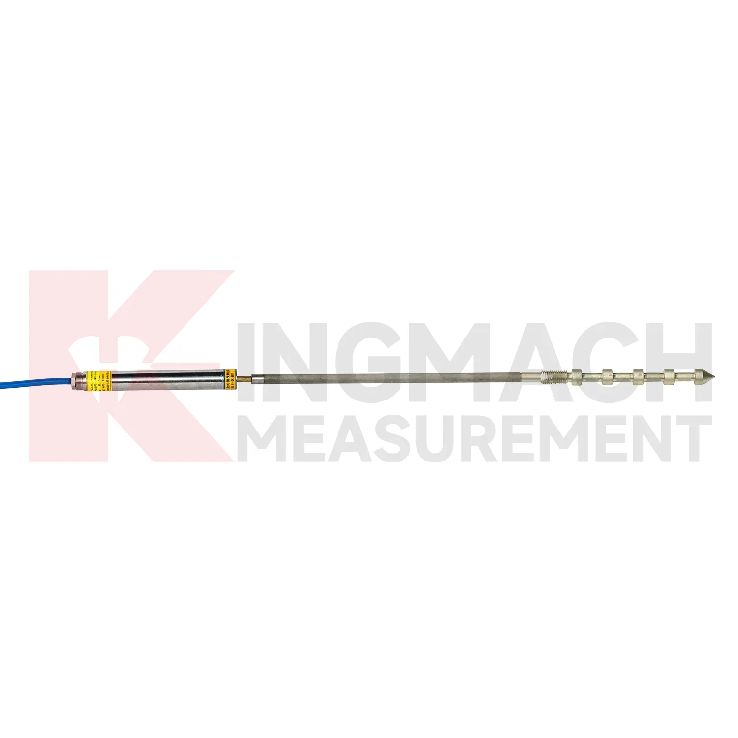
In tunnel engineering, Integrated GNSS help monitor surrounding rock deformation, lining movement, tunnel portal displacement, clearance change, and crack opening after excavation. Tunnel sites often have wet air, dust, restricted access, and changing support stages, so the instrument must hold a stable baseline through construction disturbance. Kingmach JMDL-31XXAT multipoint displacement meters use drilling and grouting with anchor heads at different depths, allowing engineers to compare the movement of separate rock layers. The series lists 50 mm, 100 mm, and 200 mm ranges with 0.01 mm resolution. JMDL-32XXAT single-point bedrock meters can be embedded with a flange, tie rod, anchor head, and PVC pipe assembly. JMLS-22XXADT wire rope sensors can watch longer displacement paths or tunnel wall clearances. These readings help site teams decide whether deformation is responding to excavation sequence, groundwater, lining timing, nearby blasting, or long-term ground pressure. During operation, the monitoring team should keep the baseline, temperature, inspection notes, and nearby sensor behavior in the same review file. This makes it easier to tell whether a movement trend comes from normal service, a repair event, changing load, water influence, or developing structural risk. Clear records also help owners decide when a field inspection is needed instead of waiting for visible damage.
The future of Integrated GNSS
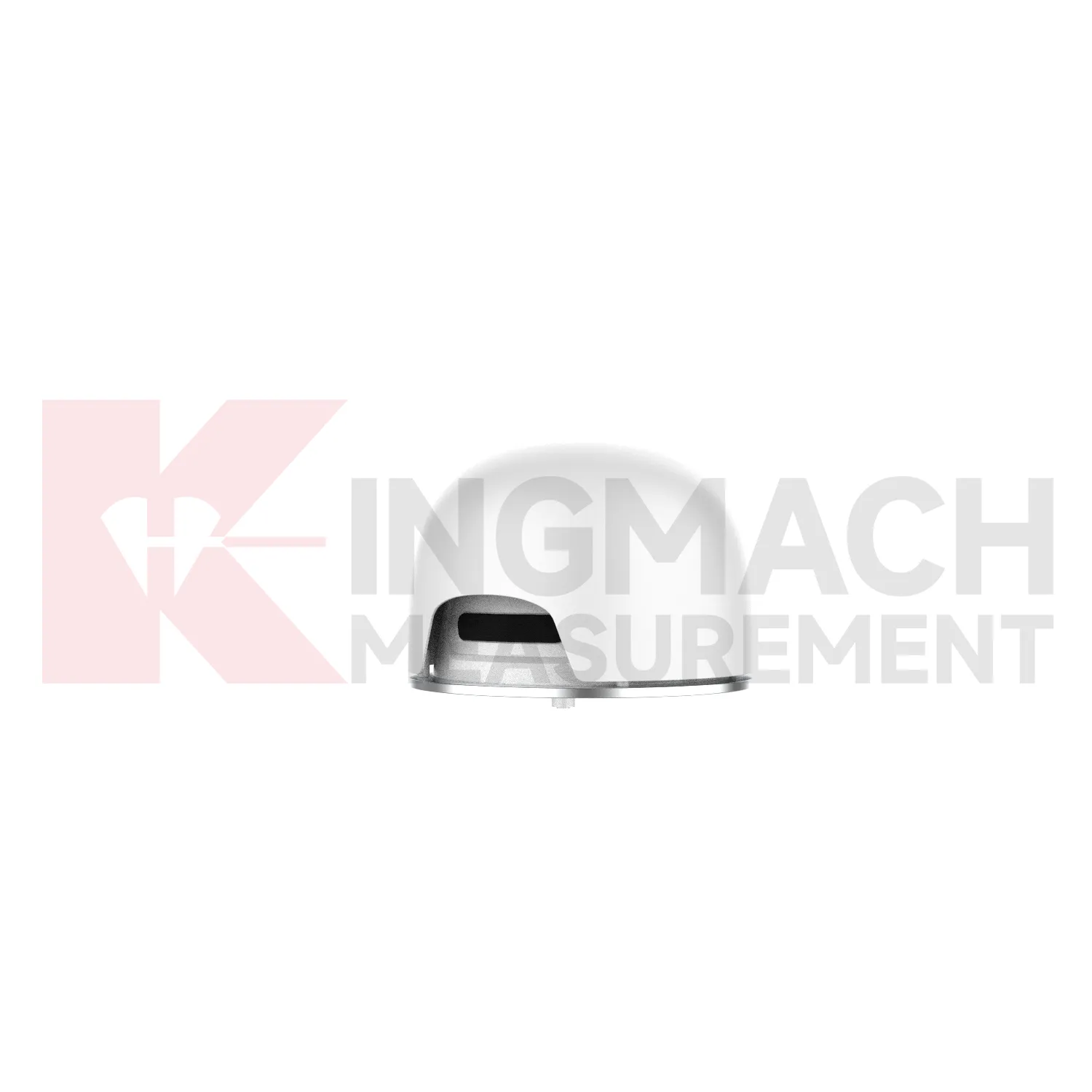
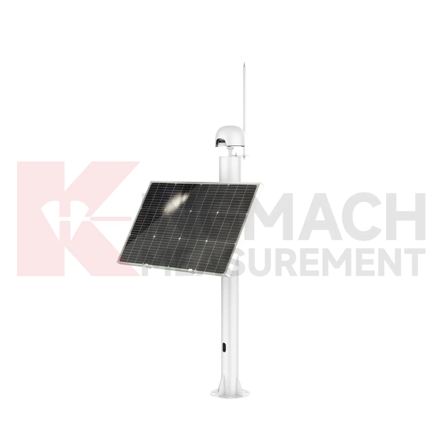
Wireless and low-power networks will change how Integrated GNSS are deployed on difficult sites. Many displacement points are located on slopes, dam shoulders, tunnel portals, remote rail subgrades, or temporary construction zones where cabling is expensive and easy to damage. Kingmach displacement products already support automatic acquisition in several forms, and future field layouts can combine wired RS485 points, LoRa or 4G gateways, solar power, and compact edge devices. The engineering task will be to preserve reliable baselines while reducing field maintenance. Sensors with built-in memory and stored calibration data help because the point can retain key identity information even when a gateway is replaced. Remote power planning, connector sealing, lightning protection, and clear channel naming will become as important as the sensor range itself. For remote terrain, the biggest gain will be fewer unnecessary site visits: teams can review battery status, data gaps, and movement direction before sending technicians into a hazardous or hard-to-access location.
Care & Maintenance of Integrated GNSS
For flexible geogrid Integrated GNSS, installation care is more important than later access because the product may be buried inside reinforced soil. Kingmach JMDL-24XXAT uses a bendable measuring rod, 30 mm and 50 mm ranges, 0.01 mm sensitivity, 0.5%FS accuracy, 20-point curve fitting, and a designed service life up to 30 years. Both ends of the geogrid should be clamped with the flexible sensor sections using mounting brackets so deformation transfers reliably. Avoid sharp bending, cable tension, bracket slippage, and damage during filling or compaction. Record the geogrid layer, chainage, depth, sensor direction, zero value, and backfill date. During operation, compare displacement with settlement and rainfall records. If the trend changes after heavy rain, traffic loading, or nearby excavation, inspect accessible cabinets and cables before deciding whether the buried geogrid movement itself has changed. Keep the installation photo, point number, zero value, and expected movement direction with the commissioning record for later review. If a reading changes after maintenance work, inspect the base, anchor, cable, and cabinet before assuming the structure itself has moved.
Kingmach Integrated GNSS
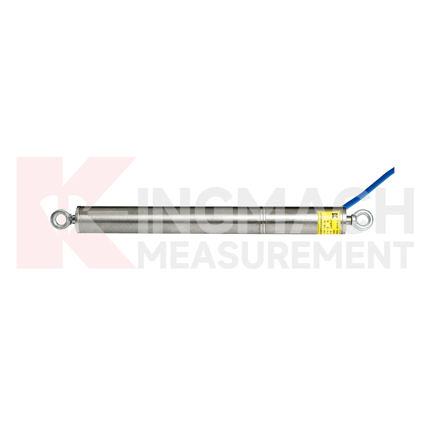
Integrated GNSS are often the quiet part of a monitoring system, but they decide whether deformation is understood as a trend or discovered as damage. Kingmach displacement products can be placed at expansion joints, cracks, foundation pits, slope faces, tunnel surrounding rock, dam bedrock, railway subgrades, high-formwork supports, and equipment stroke positions. Many models support digital transmission, anti-interference performance, waterproof sealing, and connection to automatic acquisition systems. The JMDL-21XXAT general-purpose meter records relative displacement and expansion joint movement with 50 mm or 100 mm ranges and 0.01 mm resolution. The JMDL-31XXAT multipoint meter can be installed by drilling and grouting, with anchor heads at different depths. When readings are reviewed with settlement, tilt, rainfall, pore pressure, or construction logs, engineers can see whether movement is seasonal, load-related, excavation-driven, or moving toward a control limit. The point should be named on the drawing, linked with its cable route, and checked against the expected movement direction before the first automatic reading is accepted. For daily review, the reading should be compared with nearby points, recent weather, site operations, and any loading event that could explain the movement.
FAQ
Q: Which Integrated GNSS are used for rock layers or bedrock?
A: JMDL-31XXAT multipoint meters are used for different surrounding rock layers, while JMDL-32XXAT single-point bedrock meters are used for tunnel rock mass, dam bedrock, slope, or foundation pit movement.
Q: How many points can the multipoint meter support?
A: The multipoint installation kit supports three to five monitoring points, with anchor heads fixed at different depths by drilling and grouting.
Q: What ranges are listed for these models?
A: Both JMDL-31XXAT and JMDL-32XXAT list 50 mm, 100 mm, and 200 mm models with 0.01 mm resolution.
Q: Why monitor several depths?
A: Different layers may move differently. Separating shallow and deep movement helps engineers judge whether the problem is surface creep, deeper rock slip, or overall mass movement.
Q: What records should be kept?
A: Keep drilling depth, anchor location, grouting date, channel name, zero value, cable route, and first stable reading.
Reviews
Christopher Martinez
Very satisfied with the readouts & data loggers. User-friendly interface and supports multiple sensor inputs.
Ryan Lewis
Fast delivery and excellent product quality. The accelerometers and tiltmeters are highly reliable. Strongly recommend this company.
Latest Inquiries
To protect the privacy of our buyers, only public service email domains like Gmail, Yahoo, and MSN will be displayed. Additionally, only a limited portion of the inquiry content will be shown.
Charlotte***@gmail.comUnited Arab Emirates
Hi, we require instrumentation cables suitable for harsh environments. Could you advise on specifica...
Evelyn***@gmail.comSouth Africa
Hi, we are a contractor working on tunnel construction and need settlement sensors and displacement ...
Related product categories
- displacement sensor
- laser displacement sensor
- displacement sensors
- linear displacement sensor
- optical displacement sensor
- wireless displacement sensor
- laser displacement sensors
- non contact displacement sensor
- cable displacement sensor
- draw wire displacement sensor
- inductive displacement sensor
- lvdt displacement sensor